Categories
Artificial Intelligence Climate Change Hurricanes

Voice of the Storm: MMS TTS for Global Weather Alerts

A futuristic weather station.

In the vanguard of meteorological innovation, ‘hurricane-tts‘ emerges as a monumental integration of advanced technologies, setting new standards in delivering critical storm alerts. At its core, the project harnesses the massively multilingual Text-to-Speech capabilities from Facebook AI Research (FAIR), transforming weather data into spoken word with unparalleled linguistic diversity. Coupled with the analytical prowess of ChatGPT 3.5, the system analyzes and translates complex meteorological information into actionable insights, ensuring that each forecast is not just informative but also readily comprehensible.

This confluence of Python’s programming agility, cloud computing’s scalable resources, and the interactive environment of Jupyter Notebooks culminates in a robust, serverless framework that operates with seamless efficiency. ‘hurricane-tts’ not only democratizes access to life-saving information but also epitomizes the synergy of AI and cloud technologies in crafting a real-time, user-centric response to nature’s unpredictability. It stands as a testament to the power of collaborative technology in safeguarding communities and heralding a new era of disaster preparedness.

AL22 2023 | ChatGPT 3.5 | hurricane-tts | CC0

Above is Storm AL222023, identified and forecasted by a large language model. Below, you’ll find audio advisories for this tropical storm in both Spanish and English. This service has been designed considering the storm’s potential impact on regions from Cuba and Haiti to Puerto Rico. The choice of Spanish as one of the languages is based on geolinguistic analysis and geographic coordinates. Updates on the storm’s status, forecasts, and accompanying audio are generated hourly, ensuring cost-effective and timely information.

Spanish

English

IO7, IO94 2023 | ChatGPT 3.5 | hurricane-tts | CC0

Hindi

Furthermore, our advanced multilingual deep learning model empowers this system to serve the most vulnerable regions worldwide. An example in Hindi demonstrates its current capability in hundreds of languages, with plans to expand to over 1000 languages shortly. The model has identified more than 4000 languages suitable for integration into this system. Notably, the AI has also generated an audio advisory in Bengali. This project’s text-to-speech feature is specifically designed to consider human-technology interactions globally, supporting areas with lower literacy rates to ensure broad accessibility and understanding.


Here’s a peek at the more recent screenshots if you wanted to compare the forecasts. Open sourced app is available here: Github

By Hammad Usmani

AL22 2023 + 12 hours

IO7, IO94 + 12 hours
Categories
Artificial Intelligence Climate Change Hurricanes

Unveiling the Fury of Hurricane Idalia: A Meteorological Marvel

Source

Idalia, a Category 3 hurricane, made landfall with a relentless fury, submerging homes, transforming streets into rivers, and leaving a trail of destruction in its wake. As the Southeastern coastal states grappled with its aftermath, the unique path and sheer power of Hurricane Idalia challenged preconceived notions. They underscored the need for continued research and preparedness in an era of changing climate patterns.

Devastation Unleashed: Hurricane Idalia Strikes Florida’s Gulf Coast

In an influential early morning strike on Wednesday, Hurricane Idalia landed just east of Tallahassee, Florida, at 7:45 a.m. The Category 3 storm left a path of destruction, causing significant damage along many of the Gulf Coast. Florida’s coastal communities grapple with the aftermath of this formidable hurricane.

Effects of the Cyclone

The extent of power outages in Florida is nothing short of staggering, with nearly 3.8 million households and businesses plunged into darkness, accounting for approximately 36 percent of the state’s total.

As the eye of the storm ventured further inland, the powerful onslaught continued. High winds mercilessly tore through the landscape, obliterating signs, propelling sheet metal through the air, and toppling towering trees. Starting at 7:45 a.m., Keaton Beach experienced a major landfall, marking the arrival of Category 3 hurricane, Idalia. The storm charged strong winds of nearly 125 mph (205 kph).

Idalia’s Impact on Florida: A State in Turmoil

As the first light of dawn broke over Florida, the extent of the devastation wrought by Hurricane Idalia became painfully clear. Florida was in a real mess, with destruction all around. Despite the storm’s ferocity, there were no confirmed storm-related deaths as of midday on Wednesday. However, Florida bore the unmistakable scars of Idalia’s relentless rampage.

Governor’s Alarming Address

Florida Governor Ron DeSantis stepped forward to address the state in a news conference, his tone reflective of the gravity of the situation. He voiced concerns regarding the potential storm-related casualties, underscoring the challenges first responders and communities faced. Governor DeSantis’ grave concerns resonated across Florida as the state braced for the aftermath of Idalia’s fury.

Category 2, Unyielding Force

Though downgraded to a Category 2 storm, Idalia showed no signs of relenting. The storm’s powerful winds and never-ending rain hammered Florida, leaving a path of destruction behind. Streets were inundated, transforming into treacherous waterways that disrupted daily life and posed significant safety risks. The resilience of Category 2 Idalia served as a chilling reminder of the destructive power of hurricanes.

Boats Adrift, Communities in Crisis

Boats that were once securely anchored now bobbed helplessly in the storm’s grip. Idalia’s fury affected boats, setting them adrift. They were left at the storm’s mercy. The damage was huge, and communities struggled afterward. They had to start the tough process of recovery and rebuilding.

A Deluge Foretold

The National Hurricane Center’s warning of Idalia’s impending deluge added another concern to Florida’s mounting woes. The forecast of 10 to 20 inches of rain across the Florida panhandle and into parts of Georgia and southeastern South Carolina set the stage for mass power outages. As Idalia continued its path of destruction, power grids faltered under the weight of the storm, plunging communities into darkness and further compounding the challenges faced by residents and authorities.

In the Uncertain Embrace of Idalia

During this meteorological onslaught, Florida found itself in the grip of uncertainty. The true damage remained a mystery, keeping the state and its people in suspense. Florida was in a bit of a pickle as it worked hard to recover, showing the grit and guts of its residents in tough times. In the wake of Idalia’s fury, Florida stood united, ready to rebuild and recover, demonstrating the strength of community and the indomitable human spirit in the face of nature’s most formidable challenges.

The Unprecedented Nature of Hurricane Idalia

Idalia’s impact on Florida was nothing short of remarkable. The hurricane landed in the sparsely populated Big Bend region, where the Florida Panhandle gracefully curves into the peninsula. This unconventional trajectory left meteorologists at the National Weather Service in Tallahassee astounded, leading them to label Idalia as “an unprecedented event.”

What made this distinction even more notable was that no significant hurricanes had ever traversed the bay adjacent to the Big Bend. In hurricane measurement, Idalia’s journey was unusual and left a mark on Florida’s weather history. It was a unique and extraordinary storm, challenging what we thought we knew.

The Strength and Path of Idalia

Idalia’s intensity grew significantly on its journey toward Florida. It started as a Category 2 system on Tuesday and rapidly escalated to a Category 3 storm on Wednesday before peaking as a Category 4 hurricane. It then weakened slightly but remained a potent force.

By late Tuesday night, Idalia had already reached the upper end of Category 2 with sustained winds of 110 miles per hour (177 kph). It was projected to be categorized as an intense Category 4 hurricane,   reaching dangerous levels due to the forecasted maximum sustained winds of at least 130 mph (209 kph) upon landfall.

One of the most concerning aspects of Idalia was the wind-driven high tides hitting the coasts of barrier islands and other low-lying areas along the coast. Governor DeSantis told folks in risky areas to follow evacuation orders and head for higher ground. He warned that the storm surge could lead to very dangerous floods.

The Path Forward and Impact on Surrounding States

As of 2 p.m. EDT, Idalia had crossed Florida’s coastline over the Big Bend region and was headed northeast toward Charleston, South Carolina. The National Hurricane Center forecasted that Idalia would become a tropical storm while moving over northeastern South Carolina and North Carolina coasts on Wednesday night and early Thursday.

Flash and river floods were forecasted throughout Georgia and the Carolinas through Thursday, posing significant challenges to affected communities. Tragically, two motorists died in separate rain-related crashes on Wednesday morning.

The Role of Climate Change and Warm Ocean Temperatures

According to NOAA, the region will experience frequent hurricanes, partly because of the rising ocean temperatures. The meteorological department and rescue team will be far busier in 2023 than initially predicted.

The revelation that this hurricane season was projected to be significantly more active than initially forecast is partly attributed to the rising temperatures of our oceans. This declaration underscored the mounting connection between climate change and hurricanes’ heightened frequency and intensity.

As our planet’s climate keeps shifting, the oceans are heating up, especially in the tropics. These elevated ocean temperatures provide the ideal fuel for hurricanes, enabling them to gather strength and intensify rapidly.

The 2023 hurricane season, which extends until November 30, has August and September as its traditional peak months, further exacerbating the concerns of meteorologists and climate scientists.

Insurance and Economic Implications

Hurricane Idalia’s devastating impact extends beyond the immediate destruction it wrought on communities. The economic repercussions are staggering, and UBS bank’s estimates cast a grim shadow over the financial landscape. Their calculations reveal average insured losses of $9.36 billion in Florida alone, signifying the immense financial toll on the state.

However, the bleak picture doesn’t end there. The probability of losses exceeding $4.05 billion stands at a sobering 50%, highlighting the precarious financial position many insurers and policyholders find themselves in.

There’s a problematic 10% potential that losses could balloon to a startling $25.6 billion, negatively affecting the state’s economy and citizens.

Based on data as of August 28, these forecasts highlight the unpredictability of a hurricane’s economic aftermath. These highlight how crucial it is to have thorough plans and quick reactions in place to ease the financial strain on people and communities dealing with the aftermath of big disasters.

Wrapping up

As we reflect on the relentless force of Hurricane Idalia, it becomes clear that our understanding of weather phenomena and their consequences is of utmost importance. At fluids.ai, we remain committed to providing the public with accurate and unbiased weather information, helping communities prepare for and respond to such natural disasters.

In the aftermath of Idalia’s devastating impact, more than ever, it is evident that the work of organizations like fluids.ai is vital in ensuring that the public remains informed and empowered in the face of meteorological marvels like Hurricane Idalia.

Hurricane Idalia reminds us of the importance of ongoing research, readiness, and taking action to face the increasing challenges brought by extreme weather in our changing climate. It’s a call to be prepared.

Categories
Artificial Intelligence Hurricanes

Harnessing Generative AI for Innovative Hurricane Visualization

Assisted by Midjourney. Numbers represent category from the Saffir-Simpson scale.
fluids.ai map storm EP52023 on Aug. 10th, 2023 6:00 PM
fluids.ai map storms WP62023, WP72023 on Aug. 10th, 2023 6:00 PM

Visualising the intensity and progression of hurricanes on digital platforms has seen an impressive upgrade. A diligent researcher has created a set of distinctive icons that represent the categories of the Saffir-Simpson Hurricane Wind Scale. They are hosted on a GitHub repository called hurricane-net and can be found here.

These icons, interestingly, are not just static images. They are imbued with Generative AI tech called Midjourney to create dynamic backgrounds. Midjourney was chosen over other generative models like Stable Diffusion and Dall E due to its superior performance in generating diverse yet cohesive imagery.

The choice of the Saffir-Simpson scale as a basis for these icons was driven by its color scheme, which transitions from yellow to red as the severity increases from category 1 through 4. Category 5, signifying the most potent storms, is represented by the color purple. The researcher ingeniously crafted the backgrounds of the icons to echo these color scales, resulting in an immediate visual understanding of a storm’s intensity.

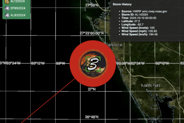
These icons serve a greater purpose than just aesthetic enhancement. They play a vital role in the fluids.ai application, where they help visualize live global tropical storms. The variability of the storm’s intensity over time, which can often be dramatic, can now be visualized effortlessly, enhancing the user experience in emergency scenarios.

The icons’ innovative design allows users to gain a quick understanding of the storm’s severity as it approaches the shore, adding a new dimension to how we perceive and react to such natural disasters.

Moreover, the source code is readily available to developers who wish to contribute or adapt these icons for their projects, exemplifying the spirit of open-source and collaborative problem-solving.

Indeed, the intersection of art, technology, and meteorology, as demonstrated in this project, offers a fresh perspective on disaster visualization, making information more digestible and impactful for all.

For those interested in getting a firsthand glimpse of this innovative blend of meteorology and Generative AI, the researcher has shared a series of web links. The ‘no cat’ link showcases an icon sans any category, offering a foundational visualization of a storm that can be accessed here. Following this, as the intensity escalates from ‘cat 1’ to ‘cat 5’, the visual vibrancy and gravity of the situation can be discerned clearly. The icons for the respective categories can be seen through these links: cat 1, cat 2, cat 3, cat 4, and the most intense, cat 5. Each link offers a window into the unique visual representation, embodying the power and scale of tropical storms.


Categories
Artificial Intelligence Climate Change Hurricanes

2023 Atlantic Hurricane Season Predictions


Prompt Used: A satellite image of the Atlantic Hurricane


Caption: A Satellite Image Of Hurricane Generated Via DALL-E

The 2022 hurricane season was cataclysmic and one of the most potent events to be ever recorded.

The National Oceanic and Atmospheric Administration (NOAA) recorded a total of 14 storms, out of which 8 turned into ruinous hurricanes, and 2 were lethal and baneful.

Florida hit rock bottom with total damage worth approximately $112.9 billion, and the loss of flora and fauna was beyond comparison. Hurricane Ian, as per the storm statistic, was the third most expensive hurricane that wiped out Florida after Hurricane Katrina in 2005 and Hurricane Harvey in 2017.

2022 has shaken everyone from the core, and people are now bracing themselves for the seasonal hurricane as 2023 is considered to bring larger devastation than customary. Certain research is being conducted regarding El Nino, and research scientist Phil Klotzbach stated that the 2023 hurricane season would be warm and moist with strong winds blowing at a more than average speed

  • Activities in the Atlantic Basin

Prompt Used: Digital Art Of Atlantic Hurricane Basin


Caption: Digital Art Of The Atlantic Hurricane Season Generated Via DALL-E

Atlantic Hurricane season usually starts on June 1st and continues till November 30th. The area that falls under the Atlantic basin covers the Atlantic Ocean, the Caribbean Sea, and the Gulf of Mexico. 

The researchers at North Carolina State University predicted that the 2023 Atlantic Season would comprise a total of 11 to 15 storms. Out of these, six to eight storms can be menacing, and two to three storms can turn into lethal and deadly hurricanes. 

Activities in the Gulf Of Mexico will also be significant. Out of the 11 to 15 storms that are likely to form in the entire Atlantic Basin, three to five storms have a high chance of originating in the Gulf of Mexico. Additionally, one to three storms have the potential to become a crucial hurricanes, and zero to one may turn into a life-threatening and ghastly hurricane. 

  • El Niño as a Primary Factor

Colorado State University has four models that study the pattern of storms and hurricanes, incorporating 25 to 40 years of data and evaluating certain aspects like –

Prompt Used: A 3D Oil Pastel Render Of Low-Pressure Forming On The Ocean


Caption: Formation Of Low Pressure On Atlantic Basin Generated Via DALL-E

The temperature of the Atlantic Sea surface

  • Pressures of the sea level
  • Changes in the speed and direction of the wind flow in accordance with the atmospheric height

El  Niño is defined as a band of warm water, usually found in the ocean and responsible for causing rainfall and temperature change globally. This happens due to the influence of either high or low air pressure. This phenomenon can last for up to four years. However, in some cases, it also lasted for about seven years.  

The team at CSU considered El Niño to be the primary factor responsible for changes in the 2023 Atlantic season. There are chances of hurricanes being torn apart while forming. El Niño can significantly increase the upper layers of the western winds that flow across the Caribbean and enter the tropical Atlantic zone. 

The CSU team stressed the uncertain facts related to the 2023 Atlantic season. Certain conflicting changes were noticed between the warm tropical and subtropical Atlantic seasons and a powerful El Niño. 

The 2023 Atlantic Hurricane season is considered to be approximately 80 % of all the seasons between 1991 to 2020 and will resemble traits like the ones in 1969, 2004, 2009, 2012, and 2015, stated Klotbach (Research scientist in the Department of Atmospheric Science)

The wind speed of at least 6 hurricanes out of the total 11 to 15 hurricanes is considered to be 74 mph, and there are chances of two hurricanes to turn into Category 3 or higher with a wind speed of 111mph. 

  • The Hot Spots of the 2023 Atlantic Hurricane Season

Another aspect of the Atlantic Hurricane Season is the occasional landslides that cease all communications. A number of studies were conducted that stated a couple of hotbeds have higher chances of getting affected in this hurricane season.

Prompt Used: A Water Colour Digital Art Of Coastal Areas During A Hurricane 

Caption: Image Of A Coastal Area Hit By A Hurricane Generated Via DALL-E

  1. Eastern Coast of Florida

Hurricane Nicole lashed the shores of the Treasure Coast and made its way to Central Florida on November 10th, 2022. This area has gone through a revival during the winter. However, the chances of landslides are maximum in this area.

Estimated dates: 30th May till 3rd June, 20th to 24th July and lastly between 8th o 13th September.

  1. Western Coast of Florida

Low pressure encircled the Gulf of Mexico and entered Florida on November 1st, 2022. The situation on the western and eastern coasts of Florida is similar, and the chances of landslides are maximum in Pan Florida. 

 Estimated dates: 22nd to 25th May, 12th to 15th July, and 31st August to 4th September.

  1. Carolina Coast

A considerable amount of low pressure was noticed in the coastal waters of the Atlantic region on 22nd October and 23rd October 2022. As a result, this area poses equal threats for landslides and water clogging.

Estimated dates: 14th to 20th May, 3rd to 10th July, and 23rd to 30th August.

  • Hurricane Prediction as per the NOAA

The National Oceanic and Atmospheric Association (NOAA) states their predictions and views related to each year’s Atlantic Season during the month of May. 

The NOAA conducts its research by considering the hurricane season forecast for the past 30 years (1992-2021 approximately). 

Prompt Used: Pop Art Of A Tornado Uprooting Trees


Caption: Image Of A Deadly Hurricane Uprooting Trees Generated Via DALL-E

The hurricane season usually starts around June and lasts through November. However the gradual climate change can alter the course, and it may begin earlier or later, depending on the current weather conditions. 

The intensity of major Hurricanes is generally defined with the help of the Saffir-Simpson Scale. This scale only takes into account the wind speed, jeopardy, and the wind surge but not the rainfall accounted.

Based on this scale, hurricanes are divided into certain categories:

Name Speed
CATEGORY 174-95mph
CATEGORY 296-110mph
CATEGORY 3111-129mph
CATEGORY 4130-156mph
CATEGORY 5 157+ mph

Although the wind speed of each category of hurricane differs, nevertheless it should not be taken lightly. A category 1 hurricane poses a threat to mankind, local flora, and fauna. 

  • Prepare for the Hurricane Season

Prompt Used: Photorealistic Art Of HumansTrapped Under A Collapsed Bridge

Caption: Humans Trapped Under A Collapsed Bride Generated Via DALL-E

As the hurricane season slowly approaches, it is imperative to safeguard the safety of your family, pets, and property. 

Here are a few tips and tricks on how you can prepare for the upcoming hurricane season:

  1. Evacuation: Always be prepared for the worst-case scenario. Keep a bag handy with medicines, flashlights, clothes, a first aid kit, and emergency supplies. Search the local routes for safe evacuation and find a place where you can secure your stay.
  2. Safeguarding your residence: Another important preparedness factor is safeguarding your home. Reinforce the walls, windows, doors, and roof. For those items that cannot be carried inside, make sure to secure them with an anchor.
  3. Subscribe to notifications and alerts: If you are staying in an area that has faced the wrath of hurricanes almost every season, it is high time that you sign up for the alerts and notifications. At the same time, you can opt for the NOAA weather radio. 

Prompt Used: 3D Cyborg Art Of Hurricane Alert Notification On Mobile Phones


Caption: Image Of Hurricane Alert Notification Generated Via DALL-E

  1. Safeguarding important documents: Keep all your important documents(identity proof, driver’s license, medical records, insurance cards, passports, etc.) inside a waterproof container
  2. Speed dial your emergency contacts: If a hurricane hits, you won’t get much time to prepare yourself in the 11th hour. Thus to ensure your safety, stay updated with the school, work, doctors, rescue services, and family members.
  • Hurricane Insurances

A hurricane with raging wind and torrential downpours can cause massive damage to your property. Therefore, you should be acquainted with two or three policies:

  1. Flood Insurance: The customary home insurance does not cover the perils of flood damage. Therefore, to save yourself a huge amount of money caused due to flood water damage, sign up for the flood insurance program through the National Flood Insurance Program, or any other private insurance company in your area.
  2. Home Insurance: Home insurances cover the damages that are caused by the main wind. That is if the roof gets damaged due to gusty wind, allowing the rainwater to enter the house, home insurance will compensate for the loss to a considerable amount. 
  1. Wind Insurance: 19 states have a hurricane deductible rate that ranges from 1 % to 10% of your residence’s insured value. You might have to get yourself a different wind insurance plan through the different State insurance plans. 
  2. Vehicle insurance: Vehicle insurance will compensate you for the damage caused to your vehicle due to the toppling of trees, howling winds, and rainfall. 

Conclusion:

Prompt Used: Digital Art Of People United During Flood


Caption: An Image of People Helping Each Other During Flood Generated Via DALL-E

When the hurricane season approaches, it is always suggested to take all the precautionary measures. Stay indoors as much as you can. Stock up on groceries, batteries, and clean water as much as possible. 

Nature is unpredictable, therefore it is always better to be a step ahead and safeguard your security. 

*****


****If you too want to generate images via AI, click on https://openai.com/product/dall-e-2

References:

  1. Metz, J. (2023, April 17). Experts Predict “Slightly Below Average” 2023 Hurricane Season. Forbes Advisor. https://www.forbes.com/advisor/homeowners-insurance/2023-hurricane-season/ 
  1. https://phys.org/news/2023-04-hurricane-season.html 
  1. Wsj. (2023, April 14). 2023 Hurricane Season Predicted to Be Below Average After a Costly 2022 | Mint. Mint. https://www.livemint.com/science/2023-hurricane-season-predicted-to-be-below-average-after-a-costly-2022-11681461513200.html 
  1. Weather, F. (2023, April 14). Experts predict slightly below-average hurricane season in Atlantic due to expected El Niño influences. New York Post. https://nypost.com/2023/04/14/experts-predict-slightly-below-average-hurricane-season-in-atlantic-due-to-expected-el-nino-influences/ 
  1. 2023 Hurricane Season Forecast. (n.d.). Almanac.com. https://www.almanac.com/content/hurricane-forecast 
  1.  Atlantic Hurricane Season Forecast 2023. (2023, March 2). StormGeo. https://www.stormgeo.com/weather/articles/atlantic-hurricane-season-forecast/2022-full-forecast/ 

*****

Categories
Climate Change Hurricanes

ATMOSPHERIC FLOODS IN CALIFORNIA

Waterlogging and floods are menacing nuisances in California that continue to persist. 

Although atmospheric rivers may appear like something out of a travelogue, they can actually do a lot of harm.

Long waves that travel in the skies like rivers do on the ground arise when water dissipates into the atmosphere and is carried by the wind.

Both mountain snow and heavy rainfall may result from them.

California Plagued by Atmospheric Floods 

The torrential downpours in California this season are also in part due to atmospheric rivers.

Between December 31, 2022, and January 25, 2023, many atmospheric rivers in California triggered periods of intense rainfall that led to floods that impacted sections of Southern California, the Californian Central Coast, Northern California, and Nevada. Property damage caused by the flooding. It was the most deadly meteorological event to date in the United States, with as well as at least 22 fatalities.

Atmospheric rivers refer to storms that are similar to rivers up in the sky that discard colossal amounts of rainfall.

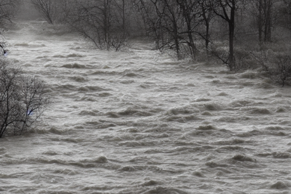
                              Image of Atmospheric Flood Generated via Stability-AI

This can cause floods and deluges even resulting in loss of property and immense risk to life. More possibilities include mudslides and landslides. 

What is the Pineapple Express? 

The Pineapple Express, a strip of water vapor that originates in Hawaii where warm conditions assist ocean waters evaporating into the sky, constitutes one of the most prominent atmospheric rivers.

Why is California most affected?

After entering the air, winds quickly transport the vapor onward, where it condenses and pours as snow or rainfall if it is raised when a front hits or crosses mountains.

It frequently sends rain to California and other western states, especially during the colder months of winter.

Atmospheric rivers can be up to 350 miles wide and 1,000 miles long (1,600 km). The federal government believes that atmospheric rivers contribute 50% of California’s average rainfall in the form of rain and snow.

          Satellite Image of Atmospheric Floods In California Generated via Stability-AI

But, the recent moisture plumes that have affected California have also coincided with other extreme weather, such as “bomb cyclones,” which is another name for a low-pressure system that is rapidly intensifying.

Thousands of households in California have been left without power and at least 35 persons have died as a result of these severe storms this year.

The West has had severe droughts, which have impacted the area’s capacity to absorb water, increasing the likelihood of flooding.

Because burn scars increase the likelihood of landslides, wildfires have also made some regions unstable.

At least 11 atmospheric rivers have already battered the state this season. Similar to a fire hose, an atmospheric river transports moisture from the air from the tropic to high elevations, where it dumps unrelenting rain or snow.

Current Situation In California

Currently, California is reeling from the ill effects of the 12th atmospheric flood that has been ravaging the state leaving thousands of people displaced and homeless. 

People have had to vacate their flooded homes and seek refuge elsewhere. 

According to CNN people’s lives have been washed down the river. 

Riverfront villages in central California were among the hardest hit over the weekend. Here, multiple tributaries distended by the overflow of rainfall and melting snow from nearby mountains were converted into raging rivers.

According to UCLA climatologist Daniel Swain, as the most recent storm approaches, he says, it’s not going to require an enormous amount of moisture to result in instantaneous overflow and increases in streams and rivers, and flooding throughout urban areas. 

Once the Pajaro River’s levee collapsed on Friday, more than 8,500 residents were required to leave. As flooding engulfed fields and agricultural communities, fifty individuals were saved.

The additional atmospheric river is making it harder to control the flooding, according to officials. Migrant farm laborers, many of whom were displaced, are ineligible for federal disaster aid. According to Luis Alejo, chairman of the Monterey county supervisory board, “over 20,000 acres of farm areas in Monterey county now will remain fallow owing to storm contamination of water, creating major employment losses and an influence on our nation’s food supply”.

           Image Of Deluge Caused due to the floods generated via Stability-AI

On Monday morning, more people were evacuated as a result of the Salinas River towards the south also overflowing. Residential streets were submerged, businesses were flooded, and portions of California’s iconic coastal Route 1 were underwater.

Northern Nevada saw avalanches, rockslides, and flooding as a result of the storms, and additional devastation is anticipated there in the days ahead. In a statement, Governor Joe Lombardo urged “all Nevadans to keep safe, travel slowly, and to follow all local advice all through the duration of this severe weather” and extended an announcement to cover northern regions as well as a handful of other counties.

               Image of people left homeless due to flood generated via Stability-AI

According to experts, the increasing occurrence and severity of these storms during periods of protracted drought are signs of human-caused climate change. The complexity of maintaining California’s scarce water supply while lowering flood and wildfire threats has intensified due to the shift from one extreme to the next.

Despite the fact that the atmospheric rivers often disrupted many Californians’ lives and caused damage to their homes and livelihoods, the subsequent rains have also helped ease the state’s protracted drought.

Only the atmospheric river from last week broke rainfall data records in Santa Barbara, Santa Maria, and Los Angeles.

The Southern California Water Board has suspended urgent drought conservation efforts for more than 7 million people due to the excessive rain.

Floods mitigated the drought situation 

According to the United States Drought Monitor, the amount of California that is currently experiencing a severe drought has decreased from 80.6% barely three months ago to barely 8% this week. Only slightly more than a third of the state is still experiencing drought.

Conclusion

Back-to-back atmospheric rivers may be just as problematic as they are helpful since the water from one storm does not have time to flow or absorb into the ground before another storm drops more. Rain and snow are typically welcome sights in the drought-stricken state.

Further atmospheric rivers are anticipated to slam the region in the second portion of March as it works to recoup from the flooding and fallen trees.

                                                                      ***

Generate similar images by clicking on https://replicate.com/stability-ai/stable-diffusion 

References  : 

  1. Levinson-King, B. R. (2023, March 13). California weather: What are the atmospheric rivers? BBC News. https://www.bbc.com/news/world-us-canada-64217329
  2. Singh, M. (2023, March 14). More ‘atmospheric river’ storms to sweep across California after days of rain and floods. The Guardian. https://www.theguardian.com/us-news/2023/mar/13/california-weather-atmospheric-river-flooding 
  3. Salahieh, N., Shackelford, R., & Yan, H. (2023a, March 20). Another atmospheric river will thrash storm-ravaged California, threatening more flooding and hurricane-force wind gusts. CNN. https://edition.cnn.com/2023/03/20/weather/california-atmospheric-river-monday/index.html
  4. Borunda, A. (2023, March 13). ‘Rivers in the sky’ are why California keeps flooding. Environment. https://www.nationalgeographic.com/environment/article/atmospheric-river-flood-rain-california-explainer 
Categories
Climate Change Hurricanes

 Current and Potential Future Aftermath of Cyclone Freddy 

Cyclone Freddy was a very fierce, surprisingly chronic, high-octane, and lethal storm that made its way across the Southern part of the Indian Ocean for almost six weeks in March and February 2023.


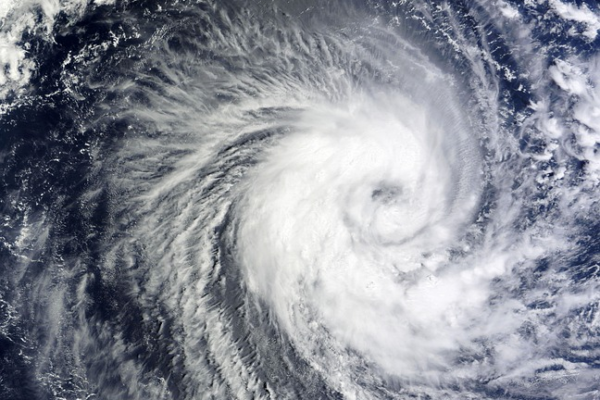
Satellite image of cyclone Freddy generated via Stability-AI

What Determined the Intensity of Cyclone Freddy?

To determine if Tropical Cyclone Freddy has surpassed the record for the most prolonged tropical cyclone ever, the International Meteorological Organization has established an expert committee. It was an officially designated tropical cyclone over 34 days, traveling more than 8,000 kilometers across the South Indian Ocean. An average entire North Atlantic hurricane season’s worth of energy is represented by the cumulative cyclone energy (an indicator used to assess the energy delivered by a tropical cyclone).

The Effects of Cyclone Freddy 

There are significant socioeconomic and humanitarian effects, but National Meteorological and Hydrological Services’ precise early warnings and synchronized disaster management on the ground saved even more casualties, underscoring the critical significance of Early Warnings for All. Early unverified sources mentioned 190 fatalities.

On March 11, Freddy made landfall in the province of Zambezia in northern Mozambique, as reported by the National Meteorological Hydrological Service (INAM). This is Freddy’s second time touching down in Mozambique.

Large areas have been affected by destructive winds, storm surges, and extremely heavy rains, notably Northeast Zimbabwe, Southeast Zambia, Malawi, and Mozambique.

Floods as a result of Cyclone Freddy generated via Stability-AI

It is anticipated that there will be 200 to 300 mm of rain overall, with as much as 400 to 500 mm falling over Mozambique’s landing zone and in the mountain ranges, potentially leading to serious floods. In a handful of days, this is more rainfall than is typically received in a month.

And over 300 to 400 mm of rain might fall in Malawi over 48 hours, resulting in flash floods and extensive flooding. People were warned to relocate to higher ground, heed any evacuation orders, avoid rivers, and migrate to higher ground by Malawi’s Directorate of Climate Change and Meteorological Services. It issued a warning about the possibility of electrical lines, pit latrines, and buildings collapsing.

Flooding from Freddy’s initial passage and from high seasonal rains, which result in overflowing rivers and soggy terrain, will be made worse by the current downpour. In the previous month, rainfall in southern Mozambique was equivalent to further than a year’s worth, while in the previous week, rainfall in Madagascar was three times the monthly normal.

On February 21 and 24, respectively, the storm initially came ashore in Madagascar and Southern Mozambique. It brought torrential rainfall and flooding as it tracked across Mozambique and Zimbabwe for several days. After picking up energy from the warm waters, it headed more toward the southwestern coast of Madagascar before circling back towards the Mozambique Channel and back towards Mozambique.

People’s Perspectives 

“On the impacted populations, Freddy is having a significant socioeconomic and humanitarian impact. Although even one victim is one too many, the death toll has been kept to a minimum thanks to accurate forecasts, early warnings, and integrated disaster risk reduction efforts on the ground “said Dr. Johan Stander, director of WMO Services.

“The UN Early Warnings for Everyone initiative’s significance in ensuring that everyone is safeguarded over the next five years is once again highlighted by this. To do this and address hazards associated with severe weather and climate change, one of the most significant problems of our time, WMO is dedicated to cooperating with our partners “said he.

The National Meteorological and Hydrological Services of Madagascar, Mozambique, and Malawi provided the WMO’s Regional Specialized Meteorological Centre La Réunion (Meteo-France) and the disaster management and humanitarian communities with early warnings of the storm, allowing for the pre-positioning of food supplies and evacuations.

Fatalities of the Cyclone 

According to the report from OCHA on 6 March, four people have perished in Madagascar as a result of the most recent rains, increasing the death toll from Freddy to at least 21 fatalities (10 in Mozambique and 11 in Madagascar). According to the Malawi Red Cross Association, 66 persons have passed away in Malawi, 93 have been injured, and 16 have been reported missing as of March 13th.

According to INGD, Mozambique’s national disaster management organization, 1.75 million people have been impacted, with over 8,000 having been relocated.

The storm that might break records Freddy was tremendous in terms of meteorology. A few hundred kilometers off the Australian northwest coast, Freddy was given the name by the Australian Bureau of Meteorology, which serves as a WMO regional center, on February 6.

Devastation as a result of Cyclone Freddy generated via Stability-AI

Freddy affected Mauritius and La Réunion on its long trek to Madagascar, traveling across the whole Indian Ocean from east to west. Such a super circumferential track is uncommon. Tropical Cyclones Leon-Eline and Hudah, including both 2000, which like 2023 was a la Nia year, were the most recent examples to be noted.

The Intergovernmental Panel on Climate Change (IPCC) reports that increases in heavy precipitation and pluvial floods have been recorded and are anticipated for Madagascar and East Southern Africa. The frequency of categories 4-5 tropical cyclones, average tropical storm wind speeds, and related heavy precipitation are all expected to increase.

Worldwide, increasing average sea levels will cause the exceptional sea levels brought on by tropical cyclones to rise as well. An increase in tropical cyclone average intensity, storm surge size, and precipitation rates will make coastal dangers worse. On a worldwide basis, there needs to be more confidence that the incidence of tropical cyclones will vary in the future.

On February 21, 2023, at 7:20 p.m. local time, Tropical Cyclone Freddy hit land 18 miles north of the town of Mananjary on Madagascar’s eastern coast. It was the storm’s first landfall after more than 4,000 miles of a journey across the Indian Ocean since it initially formed on February 5 near Indonesia. The deadly storm has so far killed five people in addition to battering the island with severe storm surges, devastation-causing winds, and torrential rainfall. The storm passed to the north of Madagascar, causing some flooding and moderate devastation on the archipelago of Mauritius and La Reunion.

Unexpected Second Landfall 

The immensely lethal  Tropical Cyclone Freddy made an unprecedented second landfall that has killed more than 216 people in Mozambique and Malawi since the 12th of March 2023. This death toll is not the final and, might rise soon. 

Electricity, phone lines, and internet connectivity remain affected to date. 

              Deaths caused by  Cyclone Freddy generated via Stability-AI

Amnesty International, the renowned Human rights group has urged the global community to deploy resources and enhance aid, help rescue, and relied on efforts in these countries. 

Freddy first surfaced in and around Australia at the beginning of February and is determined to be the longest-running tropical cyclone. 

Cyclone Freddy has been wreaking havoc in the southern part of Africa by the end of February 2023. It also belabored the island countries of Madagascar and Reunion in February as it made its way across the Indian Ocean. 

Thousands of homes have been wrecked since the Tropical Cyclone made its landfall and several people continue to be displaced and stranded at rescue shelters. The cyclone is unlikely to cease and desist anytime soon. 

Stormy winds, severe rainfall, and raging floods have left many people without homes, solace, and livelihood. 

It is predicted that the cyclone will eventually cause destruction in eastern Africa as well. 

Wrapping Up

The cyclone is not the only concern affecting the people in Malawi and Mozambique. Cholera is also a devastating aftermath of this cruel twist of nature due to the disruption of clean water supply and shortage of edible food.

We can only hope and pray that the calamity ends soon and normalcy is restored.

Prayers for the ones affected (Image generated by Stability-AI)

***

*** If you want to generate AI images click on the link; https://replicate.com/stability-ai/stable-diffusion 

****

References: 

  1. NESDIS, February 23, 2023,

Tropical Cyclone Freddy Breaks Records before Lashing Madagascar 

 www.nesdis.noaa.gov 

  1. World Meteorological Organization, 10 March 2023

Tropical Cyclone Freddy may set new record 

https://public.wmo.int/en/media/news/tropical-cyclone-freddy-may-set-new-record

3. NPR. ORG March 14, 2023,
Cyclone Freddy wrecks Malawi and Mozambique, killing more than 200 people

https://www.npr.org/2023/03/14/1163380089/cyclone-freddy-malawi-mozambique-flooding-mudslides

***

Categories
Climate Change Hurricanes

2022 Atlantic Hurricane Season

The 2022 Atlantic hurricane season started on June 1st and ended November 30th. Fourteen storms were named, out of which 2 were major hurricanes.

The NOAA forecast predicted 14 to 21 names of storms with an average speed of 39 mph or higher. Out of them, 6 to 10 were predicted to be potentially massive hurricanes with a speed of 74mph or higher. 3 to 6 were predicted to be destructive with an average wind speed of 111mph or higher. 

The 2022 Hurricane Season

Hurricanes are considered to be one of the most devastating and powerful natural calamities on Earth. Hence scientists at NASA suggest that ordinary people be prepared for such conditions. It is imperative to do everything that is required to ensure safety.

Through our collaborating with Akash Patel during the 2022 Atlantic Hurricane Season, we have successfully deployed live tropical storm reporting across the globe including live reporting of our hurricane artificial intelligence, HURAIM, for emergency responses. Through our efforts, we have identified a key business value that can provide emergency response teams an hourly product or live forecasts. Reporting is currently being offered through emails, please contact husmani@fluids.ai .

The Different Types Of Hurricane Category

Hurricanes are graded by the National Hurricane Center on a scale of 1-5. One being least fatal and five being life-threatening.

Although Category 1 and 2 cause less damage still, it is always better to take all safety measures against possible cases of injuries and accidents. 

Category 1

Category 1 storms are less dangerous and produce less damage with winds ranging from 74-95mph. Frame homes are susceptible to face damage to the roofs, shingles and siding, and gutters. Shallow-rooted trees might be uprooted and power outages could last a few days. 

Category 2

Category 2 storms are likely to cause more damage than Category 1 storms with winds blowing at 96-110 mph speeds. Homes and buildings are prone to major damage to the siding and the roofs. Innumerable trees can be uprooted and cause blockage of roads. Power outages can last for days to weeks.

Category 3 

Category 3 storms can cause havoc and severely damage homes and other high-rise buildings. Trees can be snapped from the ground and electricity and water may be unavailable for an extended period of time. Wind speed usually recorded is between 111-129mph

Category 4

Category 4 storms are catastrophic, and roofs and outer walls of buildings can be severely affected. Uprooted trees and power poles can isolate an entirely residential area. Power outages can last for weeks to months. Winds usually blow at a  speed of 130 to 156mph.

Category 5

Category 5 storms, in other words are devastating, with a wind speed of 157mph or higher. Snapped trees, collapsed bridges, and buildings can cut all connections in a residential area. Lack of fresh water and food can be witnessed in several places. Power outages can be seen for months, and the entire site becomes inhabitable for long periods. 

The 2022 Atlantic Hurricane Season: Complete Forecast

When hurricane season started, NOAA predicted three to six major hurricanes as Category 3 or even higher. The NOAA administrator Dr. Rick Spinrad also stated, “As we reflect on another potentially busy hurricane season, past storms — such as Superstorm Sandy, which devastated the New York metro area ten years ago — remind us of the impact of one storm can be felt for years.”  

The Names Of The  2022 Atlantic Tropical Cyclones:

  1. Fiona
  2. Danielle 
  3. Julia 
  4. Alex 
  5. Owen
  6. Walter
  7. Paula 
  8. Bonnie
  9. Richard 
  10. Virginie
  11. Colin 
  12. Earl 
  13. Shary
  14. Karl 
  15. Gaston 
  16. Nicole
  17. Richard
  18. Hermine
  19. Martin 
  20. Ian 
  21. Lisa

In 2021, the forecasters ran out of storm names and used certain letters from the Greek alphabet to name a few storms. The meteorologists have decided to pick up a supplemental list of names once they run out of storm names.  

How Are Hurricanes Formed

There are a lot of factors associated with how severe a hurricane can be, as per NOAA. The warmer temperature and climate change are the ruling factors to increase or decrease the speed of a storm. 

The La Nina is a phenomenon that cools the waters of the Pacific and turns the jet stream towards the north. The impacts of hurricanes El Nino and La Nina are more likely to cause turbulence between the Pacific and the Atlantic region – strengthening one part and weakening the other.  

Another primary reason to affect this season was the warm sea temperature mixed with the Atlantic trade winds and the West African Monsoon winds. 

Several studies conducted proved that weather change plays a massive role in deciding the origin and fate of a hurricane. The warm temperature causes the air to hold more moisture and makes the storms stronger, wetter, and more severe. 

The Risks

Hurricanes contribute to landfall along the coastal regions. Anyone who comes across a hurricane’s direct path is in grave danger.

For example, the massive destruction that Hurricane Fiona and Hurricane Ian caused had a significant impact on the lives of the Floridians. Bridges collapsed, communication ceased, destruction of local flora and fauna, collapsed buildings, and uprooted trees caused waterlogging and flooding at various parts. This, in turn, leads to the outbreak of several life-threatening diseases and pathogens.

Hence it is of utmost importance for people to care necessary precautions before the storm lashes out. 

Preventive Measures That Are To Be Taken

  1. Planned Evacuation

Evacuation plans should be fully implemented in a time of distress. Taking shelter in a nearby friend’s home or neighborhood should be accounted for. Bringing pets is also necessary.

  1. Gather Supplies

Gathering enough food and supplies will help you last for a few days is suggested. When the situation outside is bleak, it is always better to stay indoors and take shelter. Cash, battery-powered radios, electronics, and flashlights are of immense importance in case there is a power outage. 

  1. Insurance Policy

It is always suggested to have a strong insurance coverage policy in case there is a danger. If The flooding is massive, a separate flood insurance policy must be made. Although the exact amount cannot be estimated, certain factors are associated with hurricane damage in Florida.

  • Each hurricane policy varies and covers a different amount.
  • The prices usually fluctuate from one carrier to the next.
  • A few parts of the state are considered to be at higher risk.
  • The cost coverage is dependent on the home value.

Whether you are living in your own house or a rented apartment and the value is approximately $250,000, the dwelling cost is the same. Hence if you opt for a 5% hurricane deductible, you would need to pay $12,500, that is $250,000 x 0.05 = $12,500, towards a specific wind-related claim before the insurance company decides to go further with the rest of the hurricane damage cost.  

  1. Repair Your Home

Irrespective of the fact that you are staying elsewhere and not at your home during a hurricane, it is always better to guard your home with aluminum panels, plywood, or steel to make sure your home is ready for the storm.

  1. Brace Yourself

During a time of crisis, it is suggested that you are mentally prepared for the worst outcomes. Prepare yourself before the storm hits. The odds say that when a hurricane knocks at your door and you are not ready, the results are more likely to turn in favor of the hurricane. 

Conclusion

The lashing out of hurricanes causes a threat to human life were extremely high. The downfall in the economy and loss of life is massive. The devastation causes a lack of food and proper shelter, so adequate medical help is not received. Join us in helping out the needy in their time of distress. A little help from your end can create a massive difference in the lives of others. 

******

References:

  1. 2022 Atlantic Hurricane Season. (n.d.). https://www.nhc.noaa.gov/data/tcr/ 
  1. US Census Bureau. (2022, May 26). 2022 Atlantic Hurricane Season: June 1-November 30. Census.gov. https://www.census.gov/newsroom/stories/atlantic-hurricane-season.html 
  2. Metz, J. (2022, August 12). Experts Predict “Above Average” 2022 Hurricane Season. Forbes Advisor. https://www.forbes.com/advisor/homeowners-insurance/2022-hurricane-season/ 
  1. The 2022 Atlantic Hurricane Season is Here | U.S. Geological Survey. (2022, July 14). https://www.usgs.gov/news/featured-story/2022-atlantic-hurricane-season-here 
  1. Jones, Z. C. (2022, June 4). What to know about the 2022 Atlantic hurricane season. CBS News. https://www.cbsnews.com/news/atlantic-hurricane-season-2022-forecast-noaa/ 
  1. 2022 Atlantic hurricane season (eggmin) | Hypothetical Hurricanes. . . (n.d.). Hypothetical Hurricanes Wiki. https://hypotheticalhurricanes.fandom.com/wiki/2022_Atlantic_hurricane_season_(eggmin) 
Categories
Hurricanes

Damage Done by Hurricane Ian & Fiona

Impact of Hurricane Ian on Florida 

Hurricane Ian was a Category 4 Atlantic hurricane that uprooted Florida from the core with winds raging up to 150mph. This catastrophic hurricane hit Florida economically by US$28-63 billion. From electricity outages that lasted for countless hours to 126 fatalities in Florida, the aftermath of Ian is becoming more vivid as the storm slowly regressed.


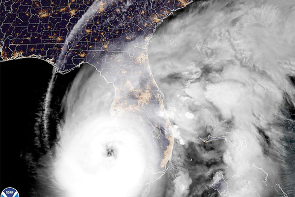
Satellite image of Hurricane Ian as it slowly gained strength and approached Florida
Flooding and electricity outages caused huge destruction in Florida

Approximately 2.5 million people were forced to take refuge in other places due to extensive flooding and torrid rainfall in parts of Florida. Rescue teams are going from one door to another in search of people that faced the wrath of Ian. Officials are still trying to aid those distressed people who lost their homes during the storm.

Massive rainfall submerged roads and caused flooding in Florida 

Florida is in dire need of support; Rescue missions are being carried out


Rescue missions are carried out via boat and aircraft. Ian shook the whole of Florida and covered the roads with ruins of broken-down buildings and uprooted trees. 

FEMA administrators stated that they are looking at both immediate and long-term needs. Restoration of electricity and safe drinking water is the primary requirement as of now and hence, adequate measures have been taken to meet the needs of the people in Florida. 

Coastal areas got no time to brace themselves

Coastal areas were hugely affected by the stormy winds of Ian

Ian originated initially from the North Atlantic region with an intensity of 70kt as a Category 3 storm. Slowly it progressed to a Category 4 storm with winds sweeping at a speed of 120mph, 140 mph and finally reaching 155mph respectively.

A storm of this magnitude stopped communications, collapsed bridges, and caused the water level to rise up to 18 feet in the coastal areas causing massive flooding. 2,160 flights were canceled, and ports were evacuated for safety reasons. 

Communication ceased as the water level rose due to rainfall and landslides.

Bridges collapsed; Communication stalled

The gradual strengthening of Ian caused landslides and rainfall that measured up to 12-20 inches in Florida. A huge number of people are still trapped in the floodwaters.

Tropical storms were observed at the Key West International Airport which recorded the third-highest storm surge after 1913. About 15 aircraft were damaged in South Florida. 

Ian’s offshore impact led to the gradual pulling out of an extensive amount of water from the Tampa Bay region. Lakes overflowed in certain parts of Central Florida. The anxiety and rush of people to save their lives led to innumerable accidents like getting drowned, and electrocution.

Impacts Of Hurricane Fiona On Florida


Satellite image of hurricane Fiona on the afternoon of September 22, 2022.

Fiona slams; Floridians face the wrath of nature

Hurricane Fiona was a Category 4 Atlantic Hurricane that created havoc in the Puerto Rico region and gradually shifted its way to Turks and Caicos Island. 

Starting as a Category 2 storm and winds raging to 115mph, Fiona later turned into a Category 4 hurricane with rainfall that measured up to 30 inches and caused flooding in the Puerto Rico region.


Collapsed buildings and ruins along the coastal region of Florida

Severe rainfall and stormy winds caused collapsing of buildings and electrical outages in various parts of Puerto Rico, which lasted for more than 48 hours and approximately 3.3 million people were without electricity, by the time Fiona slammed the island. Although electricity was restored, still the overall situation of the island is still bleak.

Destruction causes the downfall of the economy

Fiona, caused the downfall of the economy of the island by $10 billion dollars.
Only a handful of people are getting clean water supplies at the moment. 

Severe rainfall and stormy winds ceased communications in parts of Highway 10 and many people were found trapped inside several buildings in Utuado. 


To support the families affected by Fiona, an EDF grant of $5,000 was issued to provide clean water and other emergency commodities to the communities and churches in the Puerto Rico district. 

Houses were demolished and locals were forced to relocate

After storming through Puerto Rico, Fiona changed its course and continued north-west along the eastern parts of the Dominican Republic causing landslides, destruction of roads buildings, and uprooting of trees. Almost 12,000 people were forced to relocate while 2,500 homes were badly affected. 


Homeless people taking refuge to safeguard themselves from Fiona

Fiona’s winds ranged up to 88mph with waves reaching up to 40-foot. Meteorologists conducted Fiona to be one of the strongest hurricanes ever witnessed with a central pressure of 931.6millibars. 

Fiona vs Ian

The most upgraded forecasting tools considered Fiona to be stronger than Ian. Approximately four days prior to the lasing out of Fiona, it was estimated that Atlantic Canada would record the highest risk. However, before Ian made its way through Florida, the route in which it progressed was still unclear. 

Fiona traversed through the Atlantic with higher pressure and slowly made its way toward Atlantic Canada. The numerical calculation predicted Ian to be more chaotic and distinct.  

Rescue missions are being carried out, all hands at deck

Hurricanes are usually caused by heat waves and depression caused by the ocean bed. The gradual depletion of the atmospheric layers is making them potent with each passing day.
As the rescue mission still continues, it is unclear how many individuals are still missing. Hospitals and other healthcare facilities are facing significant pressure on them as the number of injured people and death toll is rising.

Come and let’s join the affected people by providing them with food, clothes, and other necessary items. Let us all help them for a better future in such hard times. 

_________________________________________________________________


References:


Wikipedia contributors. (2022, October 10). Hurricane Ian. Wikipedia. Retrieved October 10, 2022, from https://en.wikipedia.org/wiki/Hurricane_Ian 

Salahieh, N. (2022, October 5). Hurricane Ian’s death toll rises as crews in Florida go door to door in search for survivors in decimated neighborhoods. CNN. Retrieved October 10, 2022, from https://edition.cnn.com/2022/10/04/us/hurricane-ian-florida-recovery-tuesday/index.html

As Ian fades, its effects are felt from Florida through the Southeast: Live updates. (2022, October 1). NPR. Retrieved October 10, 2022, from https://www.npr.org/live-updates/hurricane-ian-storm-florida-carolinas-10-01-2022

Team, B. T. V. J. (2022, September 30). Hurricane Ian – Maps and images showing destruction. BBC News. Retrieved October 10, 2022, from https://www.bbc.com/news/world-us-canada-63078606

Floods trap many in Florida as Ian heads to South Carolina. (2022, September 30). AP NEWS. Retrieved October 10, 2022, from https://apnews.com/article/hurricane-ian-impact-path-d4db93bcac5af1134e31a3b7f2f694f0

Hurricane Ian causes devastation across central Florida, Hurricane Fiona relief continues in Puerto Rico – News. (2022, September 30). News -. Retrieved October 10, 2022, from https://www.brethren.org/news/2022/hurricane-ian-causes-devastation/

After Fiona batters Canada, Florida gulf coast braces for Ian | National Fisherman. (n.d.). Retrieved October 10, 2022, from https://www.nationalfisherman.com/national-international/after-fiona-batters-canada-florida-gulf-coast-braces-for-ian

Pelmorex Weather Networks Inc. (n.d.). Fiona vs. Ian: These hurricanes test upper limits of weather forecasting. Retrieved October 10, 2022, from https://www.theweathernetwork.com/ca/news/article/fiona-versus-ian-these-hurricanes-test-upper-limits-of-weather-forecasting-florida-atlantic-canada
 

Lewis, O. (2022, October 1). More than 1 Million Without Power as Death Toll Rises in Florida. Direct Relief. Retrieved October 10, 2022, from https://www.directrelief.org/2022/10/more-than-1-million-without-power-as-death-toll-rises-in-florida/

Wikipedia contributors. (2022a, October 10). Hurricane Fiona. Wikipedia. Retrieved October 10, 2022, from https://en.wikipedia.org/wiki/Hurricane_Fiona

Categories
Hurricanes

Hurricane Ian makes Landfall

Hurricane Ian started as a Category 3 storm and soon gained frequency to turn into a Category 4 hurricane with winds raging at 150mph, causing massive damage in Florida. The hurricane gained its strength after crossing the Gulf of Mexico and entered Florida with a speed of 130mph, turning into a Category 4 storm.

Recently, it has further strengthened and is approaching a devastating storm with maximum sustained wind speeds of up to 155 mph before it makes landfall.


The eye of the storm is predicted to make rainfall in parts of Florida later on Wednesday. Storms and winds are expected to be at hurricane force throughout the state. Based on public advisories, about 2.5 million people are requested to evacuate on an urgent basis.

Hurricane researcher, Brian McNoldy of the University of Miami, stated that it was unclear to them as to where Ian would crash aground. So, some of the locals of Tampa Bay and St.Petersburg guarded their windows and doors with sandbags. They have taken all necessary means to protect themselves from the life-threatening Hurricane Ian. 

Speedy winds swept through the entire region causing tremendous damage to innumerable health facilities. This caused power outages and cut off roads in Pinar del Rio region. Stormy winds destroyed Cuba’s world-famous tobacco belt in the La Robaina region. The province is also noted for the production of Finca Robaina cigars.

The whole province including Artemesia and Mayabeque fell victim to the hands of Ian, luckily no deaths were reported.

Ian Strengthens: Landfall in Florida

Ian is said to be the second most powerful hurricane ever recorded in the United States as per the Saffir-Simpson Hurricane Wind Scale. Winds blowing at a speed of 150mph swarmed through the southwestern coast of Florida and caused landslides in the Cayo Costa region and knocked out power in more than 1.8 million homes.

Later on Wednesday, Ian was gradually losing its strength and became a Category 3 storm with a maximum speed of 95mph with a torrential downpour. The hurricane center warned the locals of storm surges and also mentioned that water may rise up to 18 feet in certain coastal areas. Certain parts of Florida are projected to see rainfall of 12 to 20 inches.

Hurricanes are usually characterized by low-pressure and tropical cyclones rotating within a closed atmosphere. Hurricane Ian originated from the North Atlantic(current basin) with an intensity of 70kt.

A certain section of the Florida Power & Light Co. was destroyed by the stormy winds. Approximately 2,160 flights were canceled and the seaports of Jacksonville, Port Canaveral, and Tampa regions have been evacuated.

People residing in Florida pay the highest amount of home insurance in the Nation. The hurricane could cost the insurance industry claims of $20-$40 billion resulting in a huge loss in the economy.

Tornado Alert: Ian, now a Category 4 storm caused havoc in Florida

Records stated the hurricane is expected to spread inwards, towards the center of the Florida Peninsula, and will persist throughout Thursday.

Ian has gained strength and is now a Category 4 storm. Winds were blowing at a speed of 120mph at 4 am, which increased to 140mph at 5 am. The current speed of Ian is 155 mph and the center of the storm is still onshore. Chances of heavy rainfall and even flooding can be predicted over the next several hours in the southern part of the Florida Peninsula.

Strong winds are drawing in water. A storm of this magnitude can cause massive destruction in Fort Myers which is situated on the right, beside the center of the storm.

Tornado alerts have been issued by the Government, people are hereby requested to stay indoors and guard themselves.

National Weather Service of Florida Issues Safety Protocols

The National Weather Service of Florida requested everyone to keep an eye on the forecast updates and monitor the local media for any upcoming news. They also issued a number of safety protocols for the residents to safeguard themselves when the storm hits. Some of the protocols include:

  1. Use the FEMA app to receive alerts and warnings.
  2. An emergency medicine kit should be kept handy for urgent use.
  3. Stock up on groceries and other essentials.
  4. Avoid stagnant water and down power lines. Avoid driving.
  5. Keep a backup of an alternative power source in case of an electricity outage. People who are using generators as a substitute for electricity, please operate them outside your homes and safeguard yourself.

President Joe Biden Stands By Florida

President Joe Biden approved the Florida government’s Ron DeSantis’s request for an emergency declaration. This declaration includes FEMA taking advanced precautions by the state in case the situation worsens. 4,000 Florida National Guards are supporting his cause. 

FEMA is aiding people in Georgia, Florida, and Alabama with 52 ambulances, 100 paratransit seats, 117 generators, and 128,000 gallons of fuel.

A base camp has been set up in Maxwell Airforce Base to help the locals with 3.5 million liters of water, 3.7 million meals, and almost 6,380 cots. 

Apart from this, Surge Capacity Force members are rostered for additional support. Incident Management Teams are deployed to Atlanta and Tallahassee. Three Mobile Communications Operation vehicles are there to provide any assistance the State needs. 

Along with that, a team of U.S Army Corps of Engineers is progressing toward Craig Field as advanced precautionary measures.

Conclusion 

The gradual depletion of the atmospheric layers is causing hurricanes to become more potent in the coming decades. Hurricane Ian is a stark reminder of this impact and the gradual strengthening of this storm at breakneck speed is giving the coastal areas little or no time to take preventative measures.

A small initiative from your end can help innumerable distressed people. Come and stand by the affected people by providing them with food, clothes, and other amenities. You can also help them emotionally, mentally, or financially with the very little you have. 

                                                                 *******

REFERENCES

Live Updates: Hurricane Ian forecast to hit Florida’s west coast as Category 3 storm. (n.d.). Www.cbsnews.com. https://www.cbsnews.com/live-updates/hurricane-ian-tracker-florida-forecast-path-cuba-2022-09-27/ 

USDA Encourages Ag Producers, Residents to Prepare for Hurricane Ian. (n.d.). Www.usda.gov. Retrieved September 28, 2022, from https://www.usda.gov/media/press-releases/2022/09/27/usda-encourages-ag-producers-residents-prepare-hurricane-ian 

Press, A. (n.d.). Hurricane Ian knocks out power in Cuba. POLITICO. Retrieved September 28, 2022, from https://www.politico.com/news/2022/09/27/hurricane-ian-cuba-power-florida-00059175 

News, C. H., E&E. (n.d.). Hurricane Ian Intensifies into a Monster with Climate Markings. Scientific American. Retrieved September 28, 2022, from https://www.scientificamerican.com/article/hurricane-ian-intensifies-into-a-monster-with-climate-markings/ 

FEMA Continues Supporting Hurricane Ian Response | FEMA.gov. (n.d.). Www.fema.gov. Retrieved September 28, 2022, from https://www.fema.gov/press-release/20220927/fema-continues-supporting-hurricane-ian-response 

Categories
Hurricanes

Hurricane Fiona Slams: Devastation Increases

Hurricane Fiona Slams: Devastation Increases

Hurricane Fiona has shifted its course to Turks and Caicos islands after devastating Puerto Rico and the Dominican Republic. Records highlight that there was a downpour of approximately 30 inches in Puerto Rico, courtesy of Fiona.

It began as a Category 2 storm followed by torrid rainfall and turbulent winds that raised up to 115mph. The hurricane is expected to change course by Thursday and hit areas around Bermuda. It is categorized as a life-threatening Category 3 or 4 hurricane. 

Power Outage Still Continues in Puerto Rico

Official records declared almost five fatalities. Hence, the locals are advised to stay indoors and avoid travel. The flooding is expected to rise. The majority of the damage and landslides were caused by local buildings and trees collapsing. It led to massive power outages in various parts of Puerto Rico for more than 48 hours.

PowerOutage.US stated that more than 1.1 million customers were without any power supply for a long time. Electricity was restored in many places by 6:30 am Tuesday. Nevertheless, almost 80% of the island still remains in the dark. 

President Biden Announces Disaster Declaration

The lashing out of Fiona is estimated to bring down the economy of the island by $10 billion. The Governor of Puerto Rico, Pedro Pierluisi said that President Joe Biden has declared to supply additional federal funds and support to the devastated territories in this hour of emergency.  

The landslides, flooding, and power outages have damaged the filtration plants. Only a handful of locals are getting clear water supply at the moment. 

Puerto Rico National Guard To The Rescue

The Puerto Rico National Guard rescued many people from an old-age home in Cayey. Nearly 21 bedridden and aged people were removed to safety. 450 active national guard members are working day and night. Additionally, 59 other people and 13 pets were rescued from a community in Mayaguez. 

Latest updates declared that the center (eye) of the storm has now shifted from the northern coast of the Dominican Republic, about 130 miles, near the southeast region of Grand Turk.

Winds are now blowing at a speed of 100mph with heavy precipitation. The tail of Fiona is still evident in major parts of Puerto Rico and murky rainfall of 4 to 8 inches still persists in that territory. 

A Flash flood emergency was declared in certain areas due to the sudden rise in the water level of many rivers including The Rio Grande de Arecibo. The water level rose approximately 13 feet in only an hour. 

Bridge Collapses, Communication Ceases In Utuado

A huge number of people were trapped near a collapsed bridge in Utuado. This is a part of Highway 10 and acts as a link to access the University of Puerto Rico and The Utuado Campus. This bridge was reconstructed by the National Guards after Hurricane Maria in September 2017. Nearly $3 million was spent.

Bottomline 

Hurricanes are considered to be enormous heat waves. It comprises wind and rain which rise from the ocean due to depression. Depletion of air and environment are making hurricanes more potent and frequent. 

Fiona is supposed to pick up a higher pace in the coming days as it moves further north and north east. Please come forward and stand by those in this moment of distress. Join together to donate food, clothes, and other commodities or help them financially, mentally, and emotionally in such trying times. 

                                                                        *****

Reference

Finch, A. (2022, September 20). Puerto Rico outages continue in Fiona aftermath as storm moves through Turks and Caicos. Accuweather.com; AccuWeather. https://www.accuweather.com/en/hurricane/puerto-rico-outages-continue-in-fiona-aftermath-as-storm-moves-through-turks-and-caicos/1250040 

CNN, B. Dakin A., Pete Burn, Mike Hayes and Elise Hammond. (2022, September 19). September 19, 2022 Hurricane Fiona slams Puerto Rico. CNN. https://edition.cnn.com/weather/live-news/hurricane-fiona-news-09-19-22/index.html

News, A. B. C. (n.d.). Hurricane Fiona updates: Category 3 storm moves north after wreaking havoc in Puerto Rico. ABC News. https://abcnews.go.com/US/tropical-storm-fiona-leaves-dead-heads-puerto-rico/story?id=90056374 

AccuWeather. (2022). Hurricane – Category 4 Fiona 2022. Accuweather.com; AccuWeather. https://www.accuweather.com/en/hurricane/atlantic/fiona-2022

At least four killed in Puerto Rico during Hurricane Fiona, FEMA says. (2022, September 20). Washington Post. https://www.washingtonpost.com/nation/2022/09/20/hurricane-fiona-live-updates-storm-track/