About fluids
The original vision was formed in early 2017. Since then, fluids has excelled at the weather and atmospheric sciences including innovations in deep learning, artificial intelligence, and tropical storm forecasting.
The original vision was formed in early 2017. Since then, fluids has excelled at the weather and atmospheric sciences including innovations in deep learning, artificial intelligence, and tropical storm forecasting.
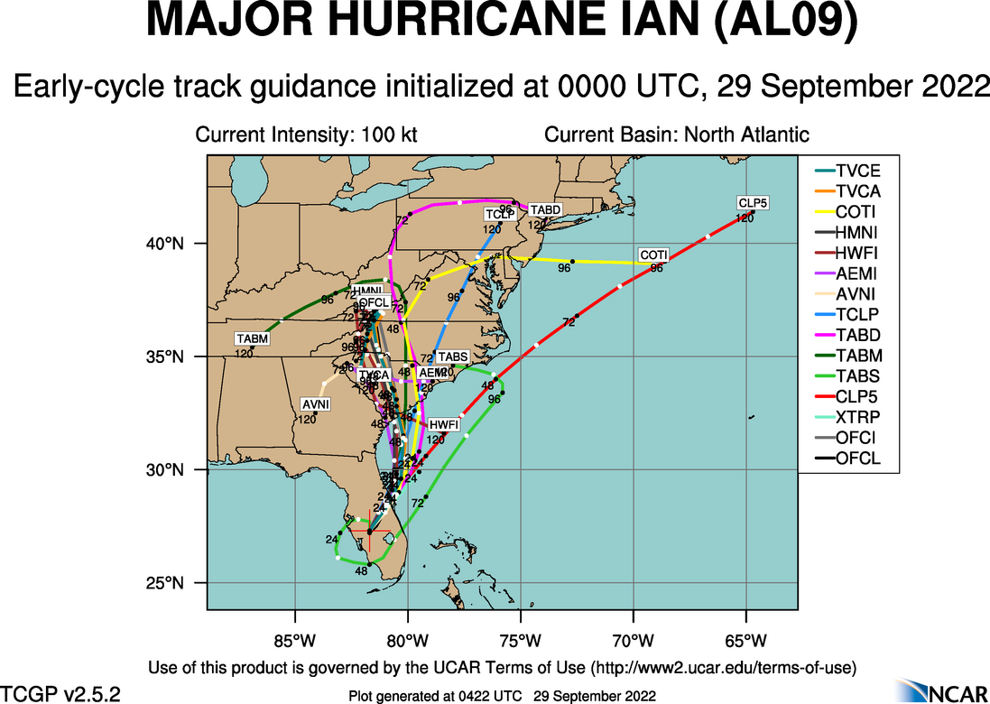
Hurricane Ian started as a Category 3 storm and soon gained frequency to turn into a Category 4 hurricane with winds raging at 150mph, causing massive damage in Florida. The hurricane gained its strength after crossing the Gulf of Mexico and entered Florida with a speed of 130mph, turning into a Category 4 storm. Recently,…
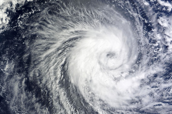
The 2022 Atlantic hurricane season started on June 1st and ended November 30th. Fourteen storms were named, out of which 2 were major hurricanes. The NOAA forecast predicted 14 to 21 names of storms with an average speed of 39 mph or higher. Out of them, 6 to 10 were predicted to be potentially massive…

“The No. 1 killer in all of these storms is water” Deanne Criswell, Federal Emergency Management Agency’s administrator The 2023 Atlantic Hurricane Season was devastating, with peak winds of 145 knots (166.86 mph), based on NOAA’s HURDAT2 data. The analysis utilizes the Saffir-Simpson scale to categorize storms, with Category 5 hurricanes like Lee representing the…

In the vanguard of meteorological innovation, ‘hurricane-tts‘ emerges as a monumental integration of advanced technologies, setting new standards in delivering critical storm alerts. At its core, the project harnesses the massively multilingual Text-to-Speech capabilities from Facebook AI Research (FAIR), transforming weather data into spoken word with unparalleled linguistic diversity. Coupled with the analytical prowess of…
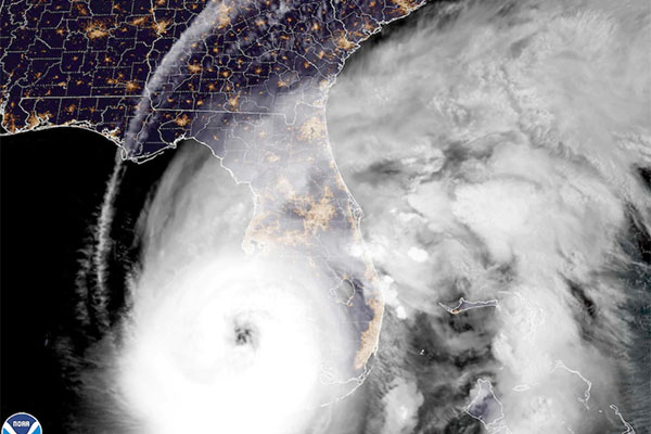
Impact of Hurricane Ian on Florida Hurricane Ian was a Category 4 Atlantic hurricane that uprooted Florida from the core with winds raging up to 150mph. This catastrophic hurricane hit Florida economically by US$28-63 billion. From electricity outages that lasted for countless hours to 126 fatalities in Florida, the aftermath of Ian is becoming more…
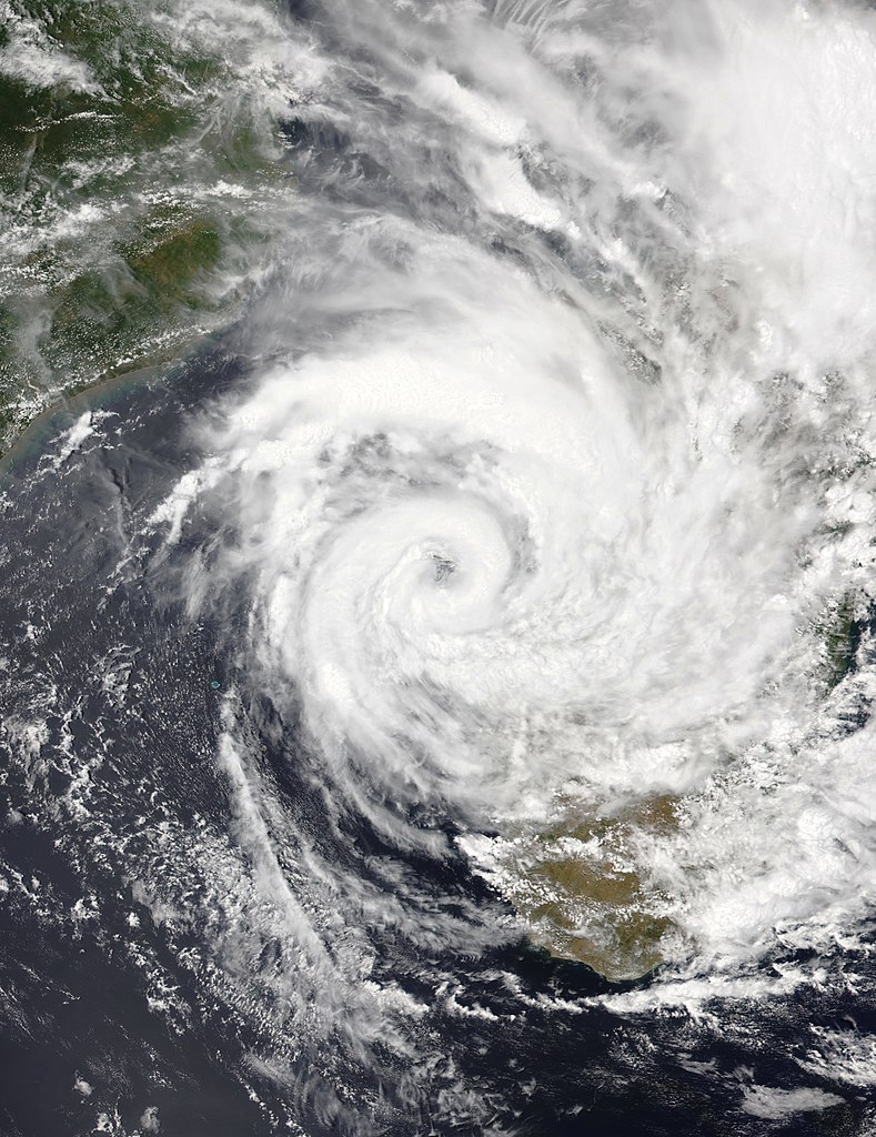
Madagascans are facing the wrath of Cheneso, which severely impacted the country and left dozens homeless and stranded in floodwaters and under collapsed bridges. Starting on the 18th of January 2023, it continued till the 29th of January when the world was looking forward to a better year; the Madagascans found themselves in a tumultuous…

50 Artistic Images Generated by Stable Diffusion about the Environment and Climate Change A Painting Of A Flood In The Style Of Vincent Van Gogh A Painting Of A Tornado In The Style Of Pablo Picasso A Painting Of Climate Change In The Style Of Leonardo da Vinci A Painting Of A Storm In The…
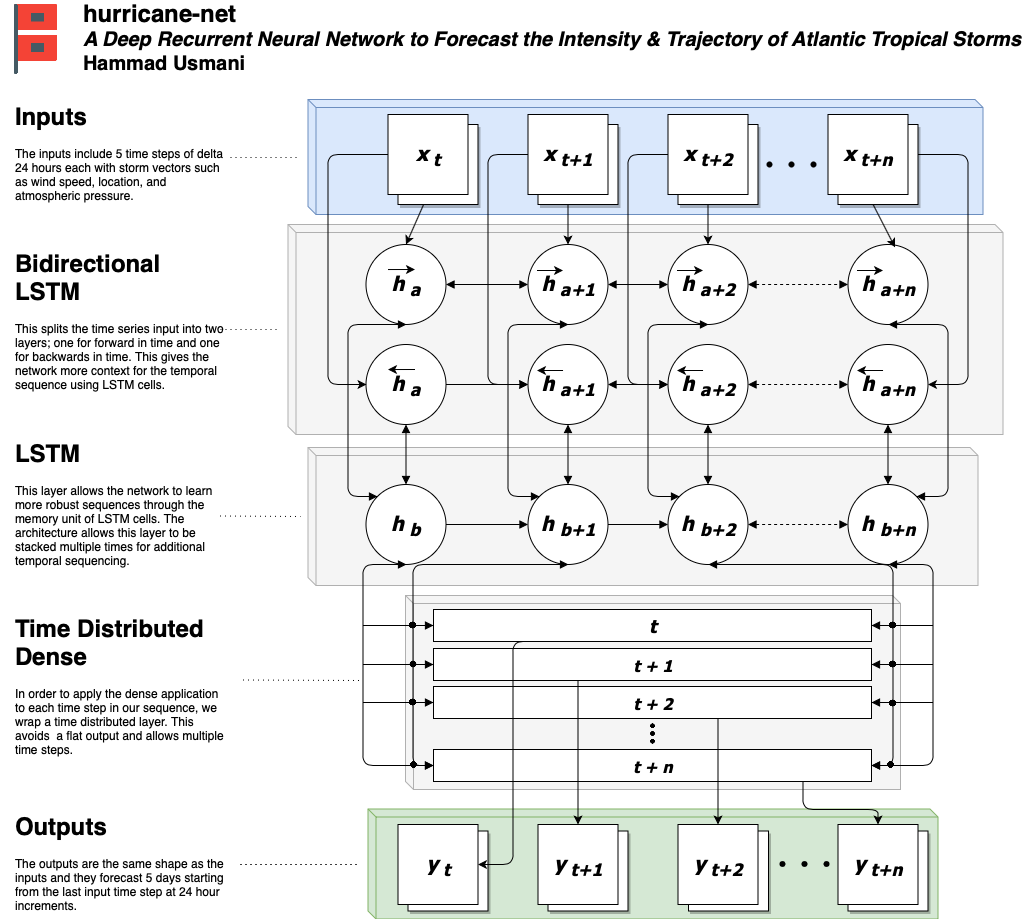
J1.6A A Deep Recurrent Neural Network to Forecast the Intensity and Trajectory of Atlantic Tropical Storms More Wednesday, 9 January 2019: 9:45 AM North 124B (Phoenix Convention Center – West and North Buildings) Hammad Usmani, Georgia Institute of Technology, Atlanta, GA Recorded Presentation The National Hurricane Center (NHC) and National Oceanic and Atmospheric Administration (NOAA)…

Visualising the intensity and progression of hurricanes on digital platforms has seen an impressive upgrade. A diligent researcher has created a set of distinctive icons that represent the categories of the Saffir-Simpson Hurricane Wind Scale. They are hosted on a GitHub repository called hurricane-net and can be found here. These icons, interestingly, are not just…